First up, Powell Point, named for John Wesley Powell (1834-1902) who was an explorer who 'filled in' the last blank spot on Western maps of the US. (Guess who took a photo of the interpretative plaque at the viewpoint!). We all thought this lump was very pretty with it's dusting of snow.


Next up, some 'badlands', water-less rough terrain that's not easy to cross. But a bit picturesque!


 |
| A flock of Jays, possibly Pinioned Jays |


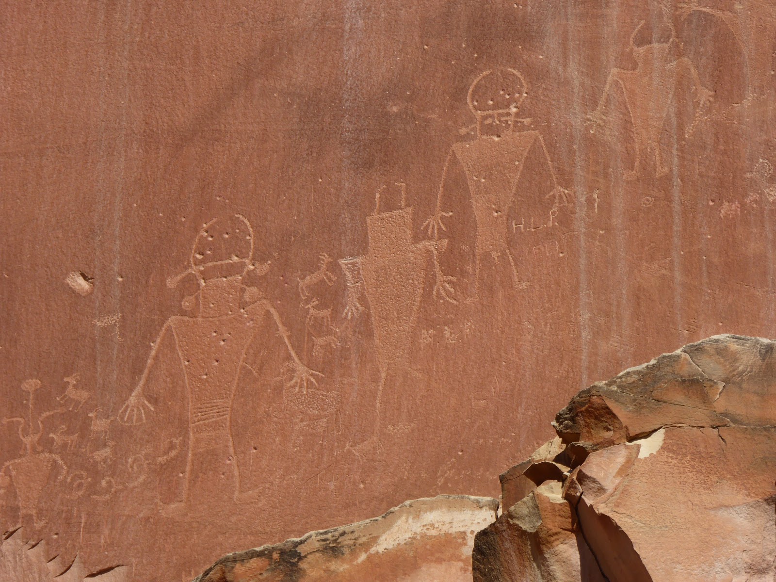
Down off the mountain and back into the red sandstone that dominates the area. We stopped in Capitol Reef NP for lunch and a look at some petroglyphs. The reef itself is another one of these massive barriers to travel, a really steep and tall cliff that runs for hundreds of miles. The petroglyphs are carved into the stone walls of some of the canyons by native american peoples. Some of them are really odd looking, like aliens or one eyed snakes with antennae. Some are goats :-) Petroglyphs should not be confused with pictograms, which are painted on, rather than carved.


Next stop was our hotel, to drop off bags, then a drive up to Dead Horse Point for a view of Canyonlands NP (which we are not actually going into this trip) at sunset. Dead Horse Point got it's name as some horrible buggers used to fence in horses they didn't want to keep/feed there (as there is a narrow bridge to get off the point). This stopped the nags from eating valuable food for 'good' horses, but basically meant they starved/dehydrated overlooking the Colorado River. I thought that was rather sickening, but I suppose they didn't want to waste money on bullets to put them out of their misery.
Anyway, the views from up there over the La Sal Mountains (Named for their year round snow looking like salt) and Canyonlands were fantastic, and the sunset was nice, if not terribly spectacular (blooming clouds and weather not being all pretty for me!)


No comments:
Post a Comment